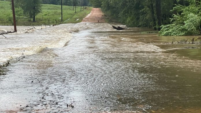
Stamps, Arkansas – Following significant flooding that hit southwest Arkansas on Wednesday morning, the City of Stamps and the National Weather Service issued a warning.
The city advises motorists to exercise caution and stay away from bridges and roads with deep water because water is rushing in the majority of areas. Many buildings and roads are reportedly receiving flood damage, and numerous power lines are down in various locations.
An estimated 12 inches of rain have already fallen, according to the National Weather Service in Shreveport, and two to four more inches of rain are possible.
According to the most recent information from Entergy, if the situation permits, power should be restored by 10:30 a.m. According to reports, most of the region from Stamps and Buckner to northern Hempstead and Lafayette counties, the region from Columbia Lake to Highway 82, is without power. North of Medlock, a sizable stretch from Columbia Road 416 up to Highway 57 S is also without power.
There are currently 601 outages in Columbia Co. and 1179 are estimated in Lafayette Co.
Flooded roads reported by the NWS include:
• Roads across Hwy 82 in Buckner are closed
• Roads across Hwy 82 in Stamps are closed
• All roads in Stamps reportedly underwater
• A.R. 313 south of Lewisville
• C.R. 38 flooded, possibly washed out
• C.R. 28 between Stamps and Lewisville is closed
• C.R. 35 is closed
• A.R. 53 north of Buckner is closed
• Lorene St. to Junction City Rd. in El Dorado
• Hwy 79 near Haynesville High School
• Hwy 520
• Hwy 32E between Hope and Bodcaw
• S. Main St. in Hope
Many of these roads are impassable, according to the NWS. Several water rescue operations are under progress, and some of these regions include trapped vehicles. Officials ask that you avoid driving in these locations for your own safety.
According to the NWS Shreveport, a flash flood emergency is currently in place for Northwestern Claiborne Parish and Southwest Columbia County until 11:45 a.m. According to reports, continuous flash flooding is dangerous. Fortunately, the strongest rain signals started to fade by 9:00 a.m.
This story is still developing. As new information becomes available, it will be made available.

